
Wexford Township topographic map
Interactive map
Click on the map to display elevation.
About this map
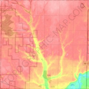
Name: Wexford Township topographic map, elevation, terrain.
Location: Wexford Township, Wexford County, Michigan, United States (44.42419 -85.81908 44.51297 -85.69640)
Average elevation: 316 m
Minimum elevation: 243 m
Maximum elevation: 338 m
Other topographic maps
Click on a map to view its topography, its elevation and its terrain.
Cadillac
United States > Michigan > Wexford County
Cadillac, Wexford County, Michigan, United States
Average elevation: 404 m