Geolocate

Scarp topographic map

Click on the map to display elevation.

About this map

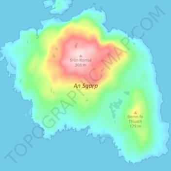
Name: Scarp topographic map, elevation, terrain.

Location: Scarp, Western Isles, Scotland, United Kingdom (58.00260 -7.17206 58.03847 -7.09862)

Average elevation: 56 m

Minimum elevation: -6 m

Maximum elevation: 305 m

Other topographic maps

Click on a map to view its topography, its elevation and its terrain.

Northbay

United Kingdom > Scotland > Western Isles

Average elevation: 44 m

Gear up for your next adventure:

🧤Rechargeable Heated Gloves - Extreme warmth for Canadian winter expeditions
🧰Emergency Multi-Tool - Compact multi-tool for outdoor survival
🎒Hiking Backpack - Lightweight and ergonomic backpacks for day hikes or multi-day treks
🔦LED Flashlight - Powerful and long-lasting flashlight for camping and emergencies
🏕️Camping Hammock - Integrated protection for sleeping between trees

As an Amazon Associate, this site earns from qualifying purchases at no extra cost to you.