Geolocate

Northbay topographic map

Click on the map to display elevation.

About this map

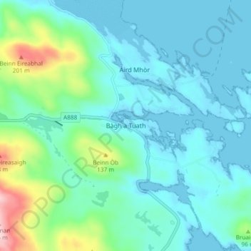
Name: Northbay topographic map, elevation, terrain.

Location: Northbay, Western Isles, Scotland, HS9 5YH, United Kingdom (56.98083 -7.44562 57.02083 -7.40562)

Average elevation: 44 m

Minimum elevation: -2 m

Maximum elevation: 241 m

Other topographic maps

Click on a map to view its topography, its elevation and its terrain.

Scarp

United Kingdom > Scotland > Western Isles

Average elevation: 56 m

Gear up for your next adventure:

🥾Trail Running Shoes - Lightweight and durable shoes for trail running
🛏️Sleeping Bag - Warm and compact sleeping bags for outdoor camping
🦶Anti-Blister Balm - Prevents friction and hotspots during long ascents
🥾Hiking Shorts - Breathable shorts suitable for summer hikes
🥾Approach Shoes - Shoes designed for climbing approaches and rugged trails

As an Amazon Associate, this site earns from qualifying purchases at no extra cost to you.