Geolocate

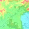
Mount Blanc topographic map

Click on the map to display elevation.

About this map

Name: Mount Blanc topographic map, elevation, terrain.

Location: Mount Blanc, Peachester, Queensland, Australia (-26.81449 152.87856 -26.81439 152.87866)

Average elevation: 175 m

Minimum elevation: 141 m

Maximum elevation: 262 m

Other topographic maps

Click on a map to view its topography, its elevation and its terrain.
Peachester

Australia > Queensland > Peachester

Average elevation: 163 m

Gear up for your next adventure:

🔥Emergency Fire Starter - Reliable ignition source for all weather conditions
🥾Waterproof Hiking Shoes - Durable shoes for wet and rugged trails
👟Trail Running Shoes - Agile footwear for fast-paced topographic exploration
🥾Trail Hiking Shoes - Durable shoes designed for rugged trails
🧊Insulated Water Bottle - Keeps drinks cold in summer and prevents freezing in winter

As an Amazon Associate, this site earns from qualifying purchases at no extra cost to you.