Geolocate

Peachester topographic map

Click on the map to display elevation.

About this map
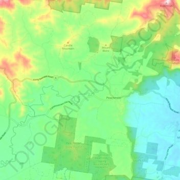
Name: Peachester topographic map, elevation, terrain.

Location: Peachester, Queensland, Australia (-26.89312 152.81059 -26.78845 152.91997)

Average elevation: 163 m

Minimum elevation: 31 m

Maximum elevation: 460 m

Other topographic maps

Click on a map to view its topography, its elevation and its terrain.
Mount Blanc

Australia > Queensland > Peachester

Average elevation: 175 m

Gear up for your next adventure:

🛶Kayak Accessories - Essential gear for safe and fun kayaking adventures
🥾Trekking Poles - Adjustable trekking poles to reduce knee stress and improve stability
🔦LED Headlamp - Hands-free lighting for early morning starts or late finishes
💧Collapsible Water Bottle - Space-saving water bottle for outdoor activities
🧣Evaporative Cooling Towel - Beat the heat during intense summer climbs

As an Amazon Associate, this site earns from qualifying purchases at no extra cost to you.