Geolocate

Seven Springs topographic map

Click on the map to display elevation.

About this map

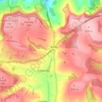
Name: Seven Springs topographic map, elevation, terrain.

Location: Seven Springs, Coberley, Cotswold District, Gloucestershire, England, GL53 9NG, United Kingdom (51.83112 -2.06946 51.87112 -2.02946)

Average elevation: 236 m

Minimum elevation: 113 m

Maximum elevation: 298 m

Other topographic maps

Click on a map to view its topography, its elevation and its terrain.

Gear up for your next adventure:

🕶️Polarized Sunglasses - Reduces glare from snow and water at high elevations
🌬️Windproof Camp Stove - Efficient cooking even on exposed mountain peaks
🪑Ultralight Camping Stool - Compact seating for rest stops during long hikes
💡LED Camping Lantern - Illuminate your campsite with long-lasting lanterns
🔭Outdoor Binoculars - Lightweight binoculars for birdwatching and hiking

As an Amazon Associate, this site earns from qualifying purchases at no extra cost to you.