Geolocate

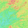
Malartic topographic map

Click on the map to display elevation.

About this map

Name: Malartic topographic map, elevation, terrain.

Location: Malartic, La Vallée-de-l'Or, Abitibi-Témiscamingue, Quebec, J0Y 1Z0, Canada (48.09780 -78.22119 48.23495 -78.00476)

Average elevation: 318 m

Minimum elevation: 292 m

Maximum elevation: 400 m

La Vallée-de-l'Or trails, hiking, mountain biking, running and outdoor activities

Other topographic maps

Click on a map to view its topography, its elevation and its terrain.
Dubuisson

Canada > Quebec > La Vallée-de-l'Or > Val-d'Or

Average elevation: 300 m

Lac Lemay

Canada > Quebec > La Vallée-de-l'Or > Val-d'Or

Average elevation: 336 m

Gear up for your next adventure:

🧢Sun Hat - Wide-brim hat for sun protection
💧Reusable Water Bottle - Durable water bottles for hydration on trails
🧥Softshell Jacket - Windproof and breathable jacket for hiking
🧊Portable Cooler - Keep food and drinks cold during outdoor adventures
🪑Insulated Seat Pad - Protect your seat from cold rocks and wet logs

As an Amazon Associate, this site earns from qualifying purchases at no extra cost to you.