Geolocate

Clutton topographic map

Click on the map to display elevation.

About this map

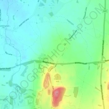
Name: Clutton topographic map, elevation, terrain.

Location: Clutton, Cheshire West and Chester, England, United Kingdom (53.07798 -2.81324 53.09432 -2.78189)

Average elevation: 40 m

Minimum elevation: 12 m

Maximum elevation: 110 m

Other topographic maps

Click on a map to view its topography, its elevation and its terrain.

Gear up for your next adventure:

🔥Camping Stove - Portable stoves to cook outdoors with ease
🕶️Polarized Sunglasses - Protect your eyes with durable polarized lenses
🧥Ultralight Puffy Jacket - Maximum warmth that packs down to the size of an orange
👟Sport Hiking Sandals - Breathable footwear for water crossings and camp rest
🥾Waterproof Hiking Shoes - Durable shoes for wet and rugged trails

As an Amazon Associate, this site earns from qualifying purchases at no extra cost to you.