Geolocate

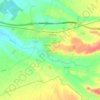
Verdú topographic map

Click on the map to display elevation.

About this map

Name: Verdú topographic map, elevation, terrain.

Location: Verdú, Urgel, Lérida, Cataluña, 25340, España (41.56766 1.07724 41.62488 1.18002)

Average elevation: 454 m

Minimum elevation: 331 m

Maximum elevation: 633 m

Other topographic maps

Click on a map to view its topography, its elevation and its terrain.
Agramunt

España > Cataluña > Urgel > Agramunt > Agramunt

Average elevation: 365 m

Bellpuig

España > Cataluña > Urgel > Bellpuig > Bellpuig

El relieve del municipio es predominantemente llano, discurriendo en su territorio el Canal de Urgel, necesario para el regadío, además del río Corb y varias acequias. El sector del término que es un poco montañoso es el que está ocupado por el municipio y las colinas que se extienden al este. La altitud…

Average elevation: 302 m
Donzell d'Urgell

España > Cataluña > Urgel > Agramunt

Average elevation: 418 m

Rocagrossa

España > Cataluña > Urgel > Vallbona de les Monges

Average elevation: 614 m

Coll d'Arboç

España > Cataluña > Urgel > Maldà

Average elevation: 439 m

Plaça del Carme

España > Cataluña > Urgel > Tàrrega

Average elevation: 381 m

Altet

España > Cataluña > Urgel > Tàrrega

Average elevation: 375 m

Montblanquet

España > Cataluña > Urgel > Vallbona de les Monges

Average elevation: 659 m

Riudovelles

España > Cataluña > Urgel > Tàrrega

Average elevation: 408 m

Altet

España > Cataluña > Urgel > Tàrrega

Average elevation: 375 m

Gear up for your next adventure:

🧣Evaporative Cooling Towel - Beat the heat during intense summer climbs
🧴Bear Spray Holster - Quick-access carry for essential Canadian wilderness safety
🦶Anti-Blister Balm - Prevents friction and hotspots during long ascents
🛏️Sleeping Bag - Warm and compact sleeping bags for outdoor camping
🧥Softshell Hiking Jacket - The perfect balance of wind protection and breathability

As an Amazon Associate, this site earns from qualifying purchases at no extra cost to you.