
Sueiro topographic map
Interactive map
Click on the map to display elevation.
About this map
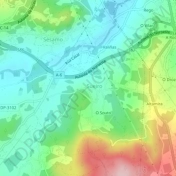
Name: Sueiro topographic map, elevation, terrain.
Location: Sueiro, Culleredo, La Coruña, Galicia, España (43.25577 -8.39465 43.27662 -8.37081)
Average elevation: 88 m
Minimum elevation: 13 m
Maximum elevation: 255 m
Other topographic maps
Click on a map to view its topography, its elevation and its terrain.