
O Burgo topographic map
Interactive map
Click on the map to display elevation.
About this map
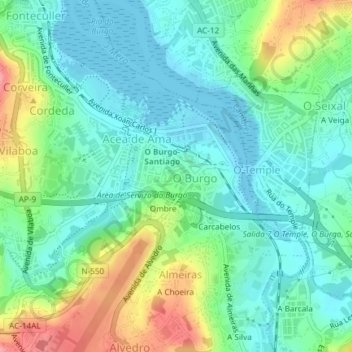
Name: O Burgo topographic map, elevation, terrain.
Location: O Burgo, Culleredo, A Coruña, Galicia, 15670, España (43.30901 -8.37599 43.32136 -8.35328)
Average elevation: 31 m
Minimum elevation: -1 m
Maximum elevation: 105 m
Other topographic maps
Click on a map to view its topography, its elevation and its terrain.