Geolocate

Lutirano topographic map

Click on the map to display elevation.

About this map
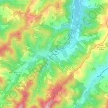
Name: Lutirano topographic map, elevation, terrain.

Location: Lutirano, Marradi, Unione Montana dei Comuni del Mugello, Firenze, Toscana, 50034, Italia (44.06078 11.68906 44.10078 11.72906)

Average elevation: 497 m

Minimum elevation: 324 m

Maximum elevation: 748 m

Other topographic maps

Click on a map to view its topography, its elevation and its terrain.

Sant'Adriano

Italia > Toscana > Firenze > Marradi

Average elevation: 348 m

Gear up for your next adventure:

🔥Emergency Fire Starter - Reliable ignition source for all weather conditions
🧥Thermal Layer - Insulating layer for cold outdoor conditions
🧦Hiking Socks - Moisture-wicking and comfortable socks for long hikes
💧Hydration Pack - Hands-free hydration system for long hikes
🛰️Satellite Messenger - Emergency communication for areas with no cell service

As an Amazon Associate, this site earns from qualifying purchases at no extra cost to you.