Geolocate

Sant'Adriano topographic map

Click on the map to display elevation.

About this map
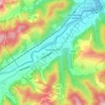
Name: Sant'Adriano topographic map, elevation, terrain.

Location: Sant'Adriano, Marradi, Unione Montana dei Comuni del Mugello, Firenze, Toscana, 50034, Italia (44.09967 11.65174 44.10568 11.66471)

Average elevation: 348 m

Minimum elevation: 234 m

Maximum elevation: 513 m

Other topographic maps

Click on a map to view its topography, its elevation and its terrain.

Lutirano

Italia > Toscana > Firenze > Marradi

Average elevation: 497 m

Gear up for your next adventure:

⛺Camping Groundsheet - Protect your tent from moisture and dirt
🥽Outdoor Goggles - Protective eyewear for outdoor activities
🚲Bike Repair Kit - Essential tools for on-trail mechanical issues
🧢Sun Hat - Wide-brim hat for sun protection
🧢Hiking Sun Hat - Wide-brimmed protection for exposed mountain ridges

As an Amazon Associate, this site earns from qualifying purchases at no extra cost to you.