Geolocate

sinkhole topographic map

Click on the map to display elevation.

About this map

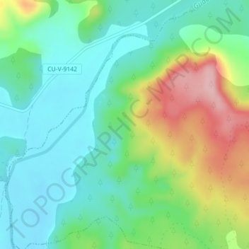
Name: sinkhole topographic map, elevation, terrain.

Location: sinkhole, Pajarón, Cuenca, Castile-La Mancha, Spain (39.98713 -1.84352 39.98888 -1.84172)

Average elevation: 1,042 m

Minimum elevation: 982 m

Maximum elevation: 1,170 m

Gear up for your next adventure:

🧴Bear Spray Holster - Quick-access carry for essential Canadian wilderness safety
🚲Heavy Duty Bike Lock - Secure your bike at the trailhead or during stops
🥾Lightweight Hiking Shoes - Comfortable shoes for day hikes
🥘Camping Cookware Set - Compact nesting pots and pans for trail cooking
Camping Coffee Maker - Brew fresh coffee anywhere on the topographic map

As an Amazon Associate, this site earns from qualifying purchases at no extra cost to you.