Geolocate

Anstey topographic map

Click on the map to display elevation.

About this map

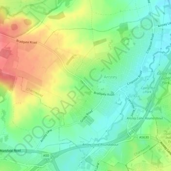
Name: Anstey topographic map, elevation, terrain.

Location: Anstey, Charnwood, Leicestershire, England, United Kingdom (52.66032 -1.21418 52.68602 -1.17074)

Average elevation: 84 m

Minimum elevation: 57 m

Maximum elevation: 123 m

Gear up for your next adventure:

🧦Outdoor Socks - Durable socks designed for hiking and outdoor sports
🔭Outdoor Binoculars - Lightweight binoculars for birdwatching and hiking
🕯️Camping Lantern - Illuminates your entire campsite with high-efficiency LEDs
🧢Hiking Hat - Sun-protective and breathable hats for long treks
🛶Waterproof Dry Bags - Keep electronics and clothes dry during river crossings

As an Amazon Associate, this site earns from qualifying purchases at no extra cost to you.