Geolocate

San Rocco Castagnaretta topographic map

Click on the map to display elevation.

About this map

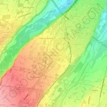
Name: San Rocco Castagnaretta topographic map, elevation, terrain.

Location: San Rocco Castagnaretta, Cuneo, Piedmont, 12100, Italy (44.34670 7.50225 44.38670 7.54225)

Average elevation: 569 m

Minimum elevation: 504 m

Maximum elevation: 627 m

Gear up for your next adventure:

🛰️Satellite Messenger - Emergency communication for areas with no cell service
💡Compact LED Flashlight - Powerful and portable flashlight for outdoor use
🥾Mountain Hiking Boots - High-traction boots for rocky terrain
Bushcraft Tarp - Versatile emergency shelter or gear protection
🥾Trail Hiking Shoes - Durable shoes designed for rugged trails

As an Amazon Associate, this site earns from qualifying purchases at no extra cost to you.