Geolocate

Holly Hill topographic map

Click on the map to display elevation.

About this map

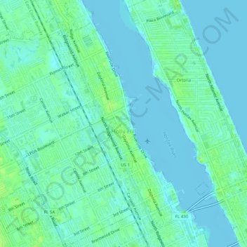
Name: Holly Hill topographic map, elevation, terrain.

Location: Holly Hill, Volusia County, Florida, 32117, United States (29.22347 -81.07375 29.26629 -81.02644)

Average elevation: 4 m

Minimum elevation: -3 m

Maximum elevation: 13 m

Other topographic maps

Click on a map to view its topography, its elevation and its terrain.

Tomoka Basin

United States > Florida > Volusia County

Average elevation: 1 m

Kalamazoo

United States > Florida > Volusia County

Average elevation: 7 m

Seville

United States > Florida > Volusia County

Average elevation: 13 m

Mound Grove

United States > Florida > Volusia County

Average elevation: 3 m

Deltona

United States > Florida > Volusia County > Deltona

Average elevation: 12 m

Cassadaga

United States > Florida > Volusia County

Average elevation: 20 m

Osteen

United States > Florida > Volusia County

Average elevation: 12 m

Ariel

United States > Florida > Volusia County > Oak Hill

Average elevation: 3 m

DeLeon Spring

United States > Florida > Volusia County

Average elevation: 12 m

Cedar Island

United States > Florida > Volusia County

Average elevation: 3 m

Barberville

United States > Florida > Volusia County

Average elevation: 12 m

Louise Lake

United States > Florida > Volusia County > Deltona

Average elevation: 11 m

Glencoe

United States > Florida > Volusia County > Glencoe

Average elevation: 8 m

Gear up for your next adventure:

🪜Heavy Duty Carabiners - Multi-use clips for securing gear to your backpack
🦶Hiking Shoe Insoles - Added support for high arches and long days on feet
🗺️Topographic Maps - Detailed maps to explore trails, mountains, and wilderness areas
🧥Thermal Fleece Jacket - Versatile insulation for changing mountain temperatures
🔥Emergency Fire Starter - Reliable ignition source for all weather conditions

As an Amazon Associate, this site earns from qualifying purchases at no extra cost to you.