Geolocate

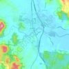
Yandina topographic map

Click on the map to display elevation.

About this map

Name: Yandina topographic map, elevation, terrain.

Location: Yandina, Sunshine Coast Regional, Queensland, 4561, Australia (-26.60128 152.91761 -26.52128 152.99761)

Average elevation: 52 m

Minimum elevation: -1 m

Maximum elevation: 292 m

Other topographic maps

Click on a map to view its topography, its elevation and its terrain.
Yandina

Australia > Queensland > Yandina

Average elevation: 33 m

Gear up for your next adventure:

🥾Waterproof Hiking Shoes - Durable shoes for wet and rugged trails
🥾Hiking Shoes - Durable and comfortable shoes for trail hiking
💧Reusable Water Bottle - Durable water bottles for hydration on trails
🥾Mountain Hiking Boots - High-traction boots for rocky terrain
🧤Rechargeable Heated Gloves - Extreme warmth for Canadian winter expeditions

As an Amazon Associate, this site earns from qualifying purchases at no extra cost to you.