Geolocate

Tuskö topographic map

Click on the map to display elevation.

About this map

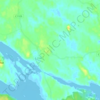
Name: Tuskö topographic map, elevation, terrain.

Location: Tuskö, Östhammars kommun, Uppsala County, Sweden (60.21759 18.47020 60.25759 18.51020)

Average elevation: 5 m

Minimum elevation: -6 m

Maximum elevation: 20 m

Other topographic maps

Click on a map to view its topography, its elevation and its terrain.

Älvkarleby kommun

Sweden > Uppsala County

Average elevation: 20 m

Östhammars kommun

Sweden > Uppsala County

Average elevation: 10 m

Hargshamn

Sweden > Uppsala County

Average elevation: 5 m

Hanelundssjön

Sweden > Uppsala County > Risbergsbo

Average elevation: 68 m

Knivsta kommun

Sweden > Uppsala County

Average elevation: 25 m

Uppsala kommun

Sweden > Uppsala County

Average elevation: 36 m

Enköpings kommun

Sweden > Uppsala County

Average elevation: 24 m

Heby kommun

Sweden > Uppsala County

Average elevation: 61 m

Gear up for your next adventure:

🥾Trail Hiking Shoes - Durable shoes designed for rugged trails
🚲MTB Frame Bag - Carry tools and maps directly on your bicycle frame
🧥Thermal Fleece Jacket - Versatile insulation for changing mountain temperatures
🛏️Camping Sleeping Mat - Comfortable mats for sleeping outdoors
🔥Emergency Fire Starter - Reliable ignition source for all weather conditions

As an Amazon Associate, this site earns from qualifying purchases at no extra cost to you.