
Kirkwood topographic map
Interactive map
Click on the map to display elevation.
About this map
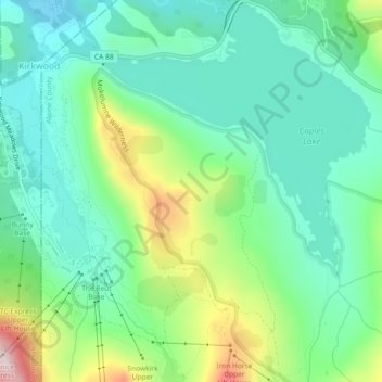
Name: Kirkwood topographic map, elevation, terrain.
Location: Kirkwood, Alpine County, California, United States (38.67316 -120.07248 38.70879 -120.03321)
Average elevation: 2,451 m
Minimum elevation: 2,313 m
Maximum elevation: 2,799 m
Other topographic maps
Click on a map to view its topography, its elevation and its terrain.
Soda Spring
United States > California > Alpine County
Soda Spring, Sawmill Creek Trail, Alpine County, California, United States
Average elevation: 1,998 m