Geolocate

Pudupet topographic map

Click on the map to display elevation.

About this map

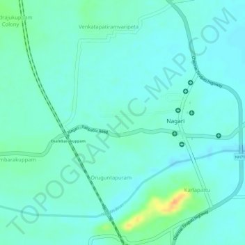
Name: Pudupet topographic map, elevation, terrain.

Location: Pudupet, Nagari, Chittoor District, Andhra Pradesh, India (13.31811 79.57593 13.32311 79.58253)

Average elevation: 117 m

Minimum elevation: 107 m

Maximum elevation: 146 m

Other topographic maps

Click on a map to view its topography, its elevation and its terrain.

Mangadu

India > Andhra Pradesh > Nagari

Average elevation: 117 m

Gear up for your next adventure:

🛶Kayak Accessories - Essential gear for safe and fun kayaking adventures
🛶Waterproof Dry Bags - Keep electronics and clothes dry during river crossings
🔪Outdoor Multitool - Versatile tool for repairs and food prep in the wild
🥾All-Terrain Hiking Boots - Versatile boots for varied hiking conditions
💧Hydration Bladder - Hands-free hydration solution for long treks

As an Amazon Associate, this site earns from qualifying purchases at no extra cost to you.