
Thank you for supporting this site ❤️
Make a donation
Make a donation
Gear up for your next adventure:
As an Amazon Associate, this site earns from qualifying purchases at no extra cost to you.
Mangadu topographic map
Click on the map to display elevation.
Thank you for supporting this site ❤️
Make a donation
Make a donation
Gear up for your next adventure:
As an Amazon Associate, this site earns from qualifying purchases at no extra cost to you.
About this map
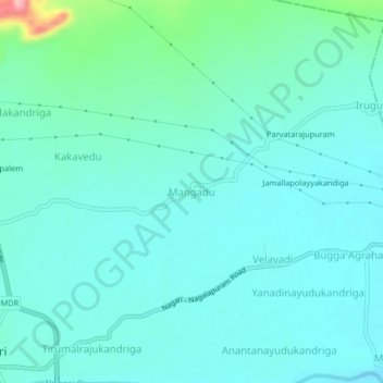
Name: Mangadu topographic map, elevation, terrain.
Location: Mangadu, Nagari, Chittoor, Andhra Pradesh, 517590, India (13.31745 79.58707 13.35745 79.62707)
Average elevation: 117 m
Minimum elevation: 95 m
Maximum elevation: 231 m
Thank you for supporting this site ❤️
Make a donation
Make a donation
Gear up for your next adventure:
As an Amazon Associate, this site earns from qualifying purchases at no extra cost to you.