Geolocate

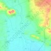
Binyamin topographic map

Click on the map to display elevation.

About this map

Name: Binyamin topographic map, elevation, terrain.

Location: Binyamin, Mount Simeon Subdistrict, Mount Simeon District, Aleppo Governorate, Syria (36.16671 37.06453 36.20671 37.10453)

Average elevation: 421 m

Minimum elevation: 377 m

Maximum elevation: 464 m

Other topographic maps

Click on a map to view its topography, its elevation and its terrain.

Lake Jabbūl

Syria > Aleppo Governorate

Average elevation: 356 m

Citadel of Aleppo

Syria > Aleppo Governorate > Aleppo

Average elevation: 393 m

Queiq

Syria > Aleppo Governorate

Average elevation: 415 m

سبخة المطخ

Syria > Aleppo Governorate

Average elevation: 245 m

Al-Hader Subdistrict

Syria > Aleppo Governorate

Average elevation: 276 m

Derbazîn Horî

Syria > Aleppo Governorate

Average elevation: 400 m

Tash

Syria > Aleppo Governorate

Average elevation: 480 m

Jindires Subdistrict

Syria > Aleppo Governorate

Average elevation: 316 m

Gear up for your next adventure:

🧴Outdoor Sunscreen - High SPF protection for high-altitude UV exposure
🧦Hiking Liner Socks - Thin base layer to prevent friction and blisters
🥾Waterproof Trail Shoes - Shoes designed to handle wet terrain
🧶550 Survival Paracord - Versatile utility cord for emergency repairs and rigging
🕶️Polarized Sunglasses - Reduces glare from snow and water at high elevations

As an Amazon Associate, this site earns from qualifying purchases at no extra cost to you.