Geolocate

Sautee topographic map

Click on the map to display elevation.

About this map

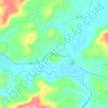
Name: Sautee topographic map, elevation, terrain.

Location: Sautee, White County, Georgia, 30571, United States (34.66454 -83.70073 34.70454 -83.66073)

Average elevation: 441 m

Minimum elevation: 397 m

Maximum elevation: 561 m

Other topographic maps

Click on a map to view its topography, its elevation and its terrain.

Helen

United States > Georgia > White County

Average elevation: 488 m

Unicoi State Park

United States > Georgia > White County > Helen

Average elevation: 540 m

Cleveland

United States > Georgia > White County

Average elevation: 479 m

Yonah

United States > Georgia > White County > Yonah

Average elevation: 491 m

Cleveland

United States > Georgia > White County

Average elevation: 479 m

Cleveland

United States > Georgia > White County

Average elevation: 479 m

Gear up for your next adventure:

🔪Outdoor Multitool - Versatile tool for repairs and food prep in the wild
🧳Compression Sacks - Maximize space in your backpack by shrinking gear
🧰Multitool Knife - Compact and versatile tool for outdoor use
🧥Insulated Jacket - Keep warm in cold outdoor conditions
🩹Compact First Aid Kit - Pre-packed essentials for common trail injuries

As an Amazon Associate, this site earns from qualifying purchases at no extra cost to you.