Geolocate

Helen topographic map

Click on the map to display elevation.

About this map

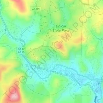
Name: Helen topographic map, elevation, terrain.

Location: Helen, White County, Georgia, 30545, United States (34.69281 -83.74280 34.72051 -83.70627)

Average elevation: 488 m

Minimum elevation: 418 m

Maximum elevation: 616 m

Gear up for your next adventure:

🕶️Polarized Sunglasses - Protect your eyes with durable polarized lenses
🛶Kayak Dry Bag - Waterproof storage for kayaking adventures
🧭Orienteering Kit - Tools for map reading and navigation in the wild
Camping Tent - Weather-resistant tents suitable for 2 to 6 people
Tent Footprint - Protect tent floor and increase durability

As an Amazon Associate, this site earns from qualifying purchases at no extra cost to you.