Geolocate

Oberweis topographic map

Click on the map to display elevation.

About this map
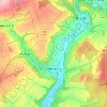
Name: Oberweis topographic map, elevation, terrain.

Location: Oberweis, Bitburger Land, Eifelkreis Bitburg-Prüm, Rijnland-Palts, Duitsland (49.94771 6.40208 49.98781 6.45804)

Average elevation: 302 m

Minimum elevation: 213 m

Maximum elevation: 402 m

Other topographic maps

Click on a map to view its topography, its elevation and its terrain.

Gear up for your next adventure:

🧦Hiking Liner Socks - Thin base layer to prevent friction and blisters
🧭GPS Handheld Device - Reliable GPS navigation for outdoor adventures
🧣Merino Neck Gaiter - Protects against wind, sun, and cold at high altitudes
🧥Ultralight Puffy Jacket - Maximum warmth that packs down to the size of an orange
🧥Insulated Jacket - Keep warm in cold outdoor conditions

As an Amazon Associate, this site earns from qualifying purchases at no extra cost to you.