Geolocate

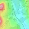
Ashes Pasture topographic map

Click on the map to display elevation.

About this map

Name: Ashes Pasture topographic map, elevation, terrain.

Location: Ashes Pasture, Horton in Ribblesdale, North Yorkshire, York and North Yorkshire, England, United Kingdom (54.19928 -2.34872 54.20519 -2.33563)

Average elevation: 315 m

Minimum elevation: 256 m

Maximum elevation: 562 m

Other topographic maps

Click on a map to view its topography, its elevation and its terrain.
Gear up for your next adventure:

🥾Trail Hiking Boots - Supportive boots for rough trails
🧥Insulated Jacket - Keep warm in cold outdoor conditions
🧢Outdoor Visor - Breathable visor for sunny hikes
🕶️Polarized Sunglasses - Reduces glare from snow and water at high elevations
⛺Bushcraft Tarp - Versatile emergency shelter or gear protection

As an Amazon Associate, this site earns from qualifying purchases at no extra cost to you.