Geolocate

Ranger topographic map

Click on the map to display elevation.

About this map

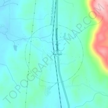
Name: Ranger topographic map, elevation, terrain.

Location: Ranger, Gordon County, Georgia, United States (34.49385 -84.71972 34.50839 -84.70208)

Average elevation: 252 m

Minimum elevation: 212 m

Maximum elevation: 416 m

Other topographic maps

Click on a map to view its topography, its elevation and its terrain.

Sugar Valley

United States > Georgia > Gordon County

Average elevation: 208 m

Ranger

United States > Georgia > Gordon County

Average elevation: 265 m

Calhoun

United States > Georgia > Gordon County > Calhoun > Calhoun

Average elevation: 206 m

Gear up for your next adventure:

🧢Outdoor Visor - Breathable visor for sunny hikes
🥾Waterproof Hiking Shoes - Durable shoes for wet and rugged trails
🧰Survival Kit - Essential gear for emergencies in the wilderness
🥾Mountain Hiking Shoes - Shoes with superior grip for mountainous terrain
🧥Insulated Jacket - Keep warm in cold outdoor conditions

As an Amazon Associate, this site earns from qualifying purchases at no extra cost to you.