Geolocate

Stocksund topographic map

Click on the map to display elevation.

About this map

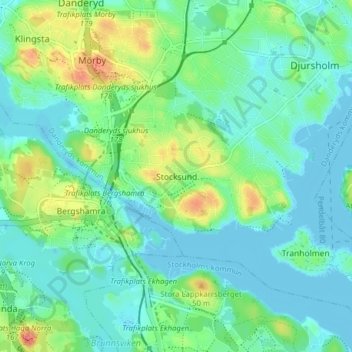
Name: Stocksund topographic map, elevation, terrain.

Location: Stocksund, Danderyds kommun, Stockholm County, 182 07, Sweden (59.36458 18.03719 59.40458 18.07719)

Average elevation: 15 m

Minimum elevation: -2 m

Maximum elevation: 54 m

Gear up for your next adventure:

🔋Lithium AA Batteries - Long-lasting power that performs in extreme cold
🔭Compact Monocular - One-handed bird watching and trail spotting
🥾Light Trekking Boots - Supportive boots for multi-day treks
🛌Insulated Sleeping Pad - Critical thermal barrier between you and the cold ground
🧴Waterproofing Spray - Restore the DWR coating on jackets and tents

As an Amazon Associate, this site earns from qualifying purchases at no extra cost to you.