Geolocate

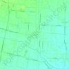
Cadoneghe topographic map

Click on the map to display elevation.

About this map

Name: Cadoneghe topographic map, elevation, terrain.

Location: Cadoneghe, Padova, Veneto, 35010, Italia (45.43664 11.89331 45.48519 11.95284)

Average elevation: 13 m

Minimum elevation: 7 m

Maximum elevation: 17 m

Other topographic maps

Click on a map to view its topography, its elevation and its terrain.
Rustega

Italia > Veneto > Padova > Camposampiero

Average elevation: 21 m

Monte Venda

Italia > Veneto > Padova > Vo'

Average elevation: 300 m

Onara

Italia > Veneto > Padova

Average elevation: 38 m

Perarolo

Italia > Veneto > Padova > Vigonza

Average elevation: 9 m

Campolongo

Italia > Veneto > Padova > Vo'

Average elevation: 121 m

Santa Maria di Non

Italia > Veneto > Padova

Average elevation: 20 m

Monte Rusta

Italia > Veneto > Padova > Faedo

Average elevation: 132 m

Villa

Italia > Veneto > Padova

Average elevation: 122 m

Caselle

Italia > Veneto > Padova > Selvazzano Dentro

Average elevation: 15 m

Ca' Molin

Italia > Veneto > Padova > Bovolenta

Average elevation: 2 m

Gear up for your next adventure:

🧥Waterproof Jacket - Lightweight rain jackets for hiking and outdoor activities
🥾Lightweight Hiking Shoes - Comfortable shoes for day hikes
🥾Trail Hiking Boots - Supportive boots for rough trails
🦶Anti-Blister Balm - Prevents friction and hotspots during long ascents
🥫Freeze-Dried Meals - Lightweight, high-calorie nutrition for multi-day treks

As an Amazon Associate, this site earns from qualifying purchases at no extra cost to you.