
Make a donation
Gear up for your next adventure:
As an Amazon Associate, this site earns from qualifying purchases at no extra cost to you.
The Cobbles topographic map
Click on the map to display elevation.
Make a donation
Gear up for your next adventure:
As an Amazon Associate, this site earns from qualifying purchases at no extra cost to you.
About this map
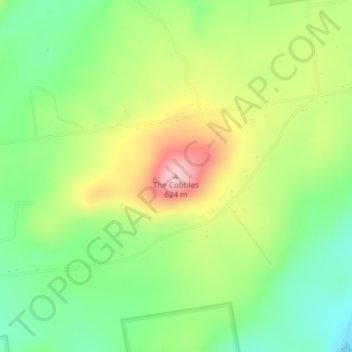
Name: The Cobbles topographic map, elevation, terrain.
Location: The Cobbles, Franklin County, New York, United States (44.43805 -74.00548 44.43815 -74.00538)
Average elevation: 521 m
Minimum elevation: 448 m
Maximum elevation: 623 m
Make a donation
Gear up for your next adventure:
As an Amazon Associate, this site earns from qualifying purchases at no extra cost to you.
Other topographic maps
Click on a map to view its topography, its elevation and its terrain.
Erie Canal
United States > New York > Erie County > City of Tonawanda
The construction of the Erie Canal was a landmark civil engineering achievement in the early history of the United States. When built, the 363-mile (584 km) canal was the second-longest in the world (after the Grand Canal in China). Initially 40 feet (12 m) wide and 4 feet (1.2 m) deep, the canal was expanded…
Average elevation: 177 m
Cayuga Lake
United States > New York > Cayuga County > Village of Union Springs
Average elevation: 264 m
Make a donation
Gear up for your next adventure:
As an Amazon Associate, this site earns from qualifying purchases at no extra cost to you.
Harriman State Park
United States > New York > Orange County > Town of Tuxedo
Average elevation: 219 m
Make a donation
Gear up for your next adventure:
As an Amazon Associate, this site earns from qualifying purchases at no extra cost to you.
Sleepy Hollow Lake
United States > New York > Greene County > Sleepy Hollow Lake
Average elevation: 28 m
Make a donation
Gear up for your next adventure:
As an Amazon Associate, this site earns from qualifying purchases at no extra cost to you.
Village of Pomona
United States > New York > Rockland County > Town of Haverstraw
Average elevation: 186 m
Catskill Park
New York's wilderness areas must be composed of 10,000 acres (4,000 ha; 40 km2) of contiguous land, twice the federal standard. Land is to be left as "untrammeled by man" and as close to its natural state as possible, offering outstanding opportunities for solitude. No artificially-powered devices are…
Average elevation: 501 m
Make a donation
Gear up for your next adventure:
As an Amazon Associate, this site earns from qualifying purchases at no extra cost to you.
Make a donation
Gear up for your next adventure:
As an Amazon Associate, this site earns from qualifying purchases at no extra cost to you.
Make a donation
Gear up for your next adventure:
As an Amazon Associate, this site earns from qualifying purchases at no extra cost to you.
Genesee River
Only a small creek (Irondequoit Creek) flows in what is left of this large paleogeologic valley. The area of the lower river was also affected. Since the earth rebounded from the melting glaciers more rapidly in Canada than in New York, water from Lake Ontario was spilled over New York due to its lower…
Average elevation: 397 m
Make a donation
Gear up for your next adventure:
As an Amazon Associate, this site earns from qualifying purchases at no extra cost to you.
Great Sacandaga Lake
United States > New York > Fulton County > Town of Hadley
Average elevation: 370 m
Susquehanna River
United States > New York > Broome County > Town of Kirkwood
Average elevation: 411 m
Make a donation
Gear up for your next adventure:
As an Amazon Associate, this site earns from qualifying purchases at no extra cost to you.
Make a donation
Gear up for your next adventure:
As an Amazon Associate, this site earns from qualifying purchases at no extra cost to you.
Make a donation
Gear up for your next adventure:
As an Amazon Associate, this site earns from qualifying purchases at no extra cost to you.
Village of New Paltz
United States > New York > Ulster County > Town of New Paltz
Average elevation: 84 m
Make a donation
Gear up for your next adventure:
As an Amazon Associate, this site earns from qualifying purchases at no extra cost to you.
Village of Valley Stream
United States > New York > Nassau County
At this time, the community did not have a post office, so residents had to pick up their mail in the village of Hempstead. After Pagan petitioned authorities for a post office, he was appointed postmaster and it was based in his farmhouse, now known as the Pagan-Fletcher House. He was advised that the…
Average elevation: 7 m
Make a donation
Gear up for your next adventure:
As an Amazon Associate, this site earns from qualifying purchases at no extra cost to you.
Make a donation
Gear up for your next adventure:
As an Amazon Associate, this site earns from qualifying purchases at no extra cost to you.
Village of Elmira Heights
United States > New York > Chemung County > Town of Horseheads
Average elevation: 278 m
Lake Mohansic
United States > New York > Westchester County > Town of Yorktown
Average elevation: 159 m
Make a donation
Gear up for your next adventure:
As an Amazon Associate, this site earns from qualifying purchases at no extra cost to you.
Make a donation
Gear up for your next adventure:
As an Amazon Associate, this site earns from qualifying purchases at no extra cost to you.
Village of Cassadaga
United States > New York > Chautauqua County > Town of Stockton
Cassadaga is located on the northwestern edge of the Allegheny Plateau in western New York at 42°20'29" north, 79°18'56" west (42.341343, -79.315653) at an elevation of approximately 1,340 feet (410 m) above sea level. The village is located at the south end of Lower Cassadaga Lake, Lily Dale being located…
Average elevation: 418 m
Make a donation
Gear up for your next adventure:
As an Amazon Associate, this site earns from qualifying purchases at no extra cost to you.
Make a donation
Gear up for your next adventure:
As an Amazon Associate, this site earns from qualifying purchases at no extra cost to you.
Charles E. Baker State Forest
United States > New York > Madison County > Town of Brookfield
Average elevation: 482 m
Murray Isle
United States > New York > Jefferson County > Town of Clayton > Grenell
Average elevation: 78 m
Make a donation
Gear up for your next adventure:
As an Amazon Associate, this site earns from qualifying purchases at no extra cost to you.
Make a donation
Gear up for your next adventure:
As an Amazon Associate, this site earns from qualifying purchases at no extra cost to you.
Make a donation
Gear up for your next adventure:
As an Amazon Associate, this site earns from qualifying purchases at no extra cost to you.
Make a donation
Gear up for your next adventure:
As an Amazon Associate, this site earns from qualifying purchases at no extra cost to you.
Make a donation
Gear up for your next adventure:
As an Amazon Associate, this site earns from qualifying purchases at no extra cost to you.
Make a donation
Gear up for your next adventure:
As an Amazon Associate, this site earns from qualifying purchases at no extra cost to you.
Shindagin Hollow State Forest
United States > New York > Tompkins County > Town of Caroline
Average elevation: 457 m
Lake Roxanne
United States > New York > Clinton County > Town of Ellenburg > Ellenburg Depot
Average elevation: 280 m
Make a donation
Gear up for your next adventure:
As an Amazon Associate, this site earns from qualifying purchases at no extra cost to you.
Make a donation
Gear up for your next adventure:
As an Amazon Associate, this site earns from qualifying purchases at no extra cost to you.