Geolocate

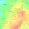
Le Grand Hallier topographic map

Click on the map to display elevation.

About this map

Name: Le Grand Hallier topographic map, elevation, terrain.

Location: Le Grand Hallier, Martigné-sur-Mayenne, Mayenne, Pays de la Loire, France métropolitaine, 53470, France (48.16684 -0.67771 48.20684 -0.63771)

Average elevation: 129 m

Minimum elevation: 103 m

Maximum elevation: 166 m

Other topographic maps

Click on a map to view its topography, its elevation and its terrain.
53470

France > Pays de la Loire > Mayenne > Martigné-sur-Mayenne

Average elevation: 120 m

Gear up for your next adventure:

👟Leg Gaiters - Keep debris, mud, and snow out of your boots
🪜Heavy Duty Carabiners - Multi-use clips for securing gear to your backpack
🧥Thermal Layer - Insulating layer for cold outdoor conditions
🚲MTB Frame Bag - Carry tools and maps directly on your bicycle frame
👟Trail Running Shoes - Agile footwear for fast-paced topographic exploration

As an Amazon Associate, this site earns from qualifying purchases at no extra cost to you.