Geolocate

Taskers topographic map

Click on the map to display elevation.

About this map
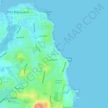
Name: Taskers topographic map, elevation, terrain.

Location: Taskers, Port Macquarie, Port Macquarie-Hastings Council, New South Wales, 2444, Australia (-31.46555 152.90603 -31.42555 152.94603)

Average elevation: 13 m

Minimum elevation: -4 m

Maximum elevation: 108 m

Other topographic maps

Click on a map to view its topography, its elevation and its terrain.
Gear up for your next adventure:

🧴Sunscreen SPF - Broad-spectrum sunscreen for outdoor activities
🚲Bike Repair Kit - Essential tools for on-trail mechanical issues
🥾Mountain Hiking Boots - High-traction boots for rocky terrain
🧳Compression Sacks - Maximize space in your backpack by shrinking gear
🔭Outdoor Binoculars - Lightweight binoculars for birdwatching and hiking

As an Amazon Associate, this site earns from qualifying purchases at no extra cost to you.