Geolocate

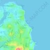
Flynns Beach topographic map

Click on the map to display elevation.

About this map

Name: Flynns Beach topographic map, elevation, terrain.

Location: Flynns Beach, Port Macquarie, Port Macquarie-Hastings Council, New South Wales, 2444, Australia (-31.44475 152.92561 -31.44101 152.92836)

Average elevation: 13 m

Minimum elevation: 0 m

Maximum elevation: 61 m

Other topographic maps

Click on a map to view its topography, its elevation and its terrain.
Taskers

Australia > New South Wales > Port Macquarie

Average elevation: 13 m

Gear up for your next adventure:

🔦LED Headtorch - Bright and durable light for night activities
🥾Mountain Hiking Boots - High-traction boots for rocky terrain
🧴Outdoor Sunscreen - High SPF protection for high-altitude UV exposure
🧦Crew Hiking Socks - Comfortable socks for long-distance hikes
🧥Waterproof Hiking Jacket - Protect yourself from rain and wind while hiking

As an Amazon Associate, this site earns from qualifying purchases at no extra cost to you.