Geolocate

Midway topographic map

Click on the map to display elevation.

About this map
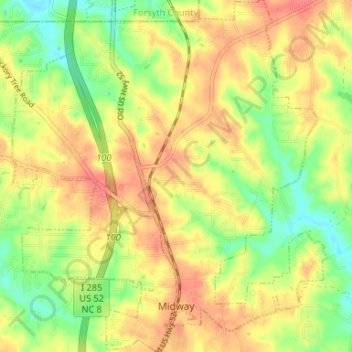
Name: Midway topographic map, elevation, terrain.

Location: Midway, Davidson County, North Carolina, United States (35.94642 -80.24885 35.99990 -80.18962)

Average elevation: 257 m

Minimum elevation: 225 m

Maximum elevation: 282 m

Other topographic maps

Click on a map to view its topography, its elevation and its terrain.
Linwood

United States > North Carolina > Davidson County

Average elevation: 207 m

Jersey

United States > North Carolina > Davidson County

Average elevation: 202 m

Gear up for your next adventure:

⛺Lightweight Camping Tent - Portable shelter optimized for Canadian backcountry camping
🧊Portable Cooler - Keep food and drinks cold during outdoor adventures
🧤Thermal Hiking Gloves - Grip-enhanced gloves for cold-weather altitude trekking
💧Filtered Water Bottle - Safe drinking water on the go
🔪Outdoor Multitool - Versatile tool for repairs and food prep in the wild

As an Amazon Associate, this site earns from qualifying purchases at no extra cost to you.