Geolocate

Meopham topographic map

Click on the map to display elevation.

About this map

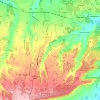
Name: Meopham topographic map, elevation, terrain.

Location: Meopham, Gravesham, Kent, England, United Kingdom (51.32545 0.33142 51.39488 0.39252)

Average elevation: 124 m

Minimum elevation: 32 m

Maximum elevation: 217 m

Other topographic maps

Click on a map to view its topography, its elevation and its terrain.

Chalk

United Kingdom > England > Kent > Gravesham

Average elevation: 27 m

Gear up for your next adventure:

🛏️Sleeping Bag - Warm and compact sleeping bags for outdoor camping
🧰Multitool Knife - Compact and versatile tool for outdoor use
🎒Hiking Backpack - Lightweight and ergonomic backpacks for day hikes or multi-day treks
Backpacking Tent - Lightweight tent for long-distance hiking trips
🧣Merino Neck Gaiter - Protects against wind, sun, and cold at high altitudes

As an Amazon Associate, this site earns from qualifying purchases at no extra cost to you.