
Chute-à-Blondeau topographic map
Interactive map
Click on the map to display elevation.
About this map
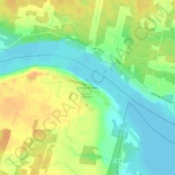
Name: Chute-à-Blondeau topographic map, elevation, terrain.
Average elevation: 56 m
Minimum elevation: 38 m
Maximum elevation: 76 m
Other topographic maps
Click on a map to view its topography, its elevation and its terrain.
Voyageur Provincial Park
Canada > Ontario > Prescott and Russell Counties > East Hawkesbury
Voyageur Provincial Park, Highway 417, East Hawkesbury, Prescott and Russell Counties, Eastern Ontario, Ontario, K0B 1B0, Canada
Average elevation: 46 m