Geolocate

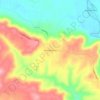
Concord topographic map

Click on the map to display elevation.

About this map

Name: Concord topographic map, elevation, terrain.

Location: Concord, Cleburne County, Arkansas, 72523, United States (35.65265 -91.87769 35.67451 -91.82196)

Average elevation: 297 m

Minimum elevation: 215 m

Maximum elevation: 339 m

Other topographic maps

Click on a map to view its topography, its elevation and its terrain.
Tannenbaum

United States > Arkansas > Cleburne County

Average elevation: 179 m

Prim

United States > Arkansas > Cleburne County

Average elevation: 353 m

Ida

United States > Arkansas > Cleburne County

Average elevation: 282 m

Hopewell

United States > Arkansas > Cleburne County

Average elevation: 254 m

Edgemont

United States > Arkansas > Cleburne County

Average elevation: 178 m

Concord

United States > Arkansas > Cleburne County > Concord > Concord

Average elevation: 298 m

Eden Isle

United States > Arkansas > Cleburne County

Average elevation: 215 m

West Pangburn

United States > Arkansas > Cleburne County

Average elevation: 142 m

Gear up for your next adventure:

🧭GPS Outdoor Watch - Smart watch for navigation and fitness tracking in nature
🧥Packable Rain Jacket - Breathable waterproof layer for unpredictable weather
🧥Waterproof Pants - Keep dry during rainy hiking conditions
🧴Bear Spray Holster - Quick-access carry for essential Canadian wilderness safety
👖Convertible Hiking Pants - Zip-off legs to adapt to changing weather conditions

As an Amazon Associate, this site earns from qualifying purchases at no extra cost to you.