Geolocate

Isla Mujeres topographic map

Click on the map to display elevation.

About this map

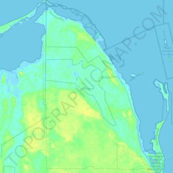
Name: Isla Mujeres topographic map, elevation, terrain.

Location: Isla Mujeres, Quintana Roo, Mexico (21.20154 -87.10582 21.60550 -86.71065)

Average elevation: 3 m

Minimum elevation: -2 m

Maximum elevation: 12 m

Other topographic maps

Click on a map to view its topography, its elevation and its terrain.

Chacchoben

Mexico > Quintana Roo > Bacalar

Average elevation: 10 m

Gear up for your next adventure:

🥾Trail Hiking Boots - Supportive boots for rough trails
Camping Coffee Maker - Brew fresh coffee anywhere on the topographic map
🥽Outdoor Goggles - Protective eyewear for outdoor activities
💡LED Camping Lantern - Illuminate your campsite with long-lasting lanterns
🥾Lightweight Hiking Shoes - Comfortable shoes for day hikes

As an Amazon Associate, this site earns from qualifying purchases at no extra cost to you.