
Mount Slaggard topographic map
Interactive map
Click on the map to display elevation.
About this map
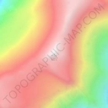
Name: Mount Slaggard topographic map, elevation, terrain.
Location: Mount Slaggard, Yukon, Canada (61.17256 -140.58508 61.17266 -140.58498)
Average elevation: 4,229 m
Minimum elevation: 3,368 m
Maximum elevation: 4,735 m
Other topographic maps
Click on a map to view its topography, its elevation and its terrain.
Herschel Island
Herschel Island, Inuvialuit Settlement Region, Yukon, Canada
Average elevation: 22 m
Tombstone Territorial Park
Tombstone Territorial Park, Yukon, Canada
Average elevation: 1,546 m
Dawson City
Canada > Yukon > Dawson City
Dawson City, Town of Dawson City, Yukon, Unorganized, Yukon, Canada
Average elevation: 510 m
Kluane National Park and Reserve
Kluane National Park and Reserve, Yukon, Canada
Average elevation: 1,536 m
Kusawa Lake;Takhini River
Kusawa Lake;Takhini River, Yukon, Canada
Average elevation: 705 m
Lake Laberge
Lake Laberge, Macpherson-Grizzly Valley, Yukon, Canada
Average elevation: 710 m
Burwash Landing
Canada > Yukon > Burwash Landing
Burwash Landing, Yukon, Y1A 3V4, Canada
Average elevation: 828 m
Teslin Lake
Canada > Yukon > Teslin Post 13
Teslin Lake, Teslin Post 13, Yukon, Canada
Average elevation: 1,084 m
Two Mile Village
Canada > Yukon > Watson Lake
Two Mile Village, Watson Lake, Yukon, Y0A 1C0, Canada
Average elevation: 703 m
Little Salmon Lake
Little Salmon Lake, Yukon, Unorganized, Yukon, Canada
Average elevation: 694 m
Kluane Lake
Canada > Yukon > Burwash Landing
Kluane Lake, Sedata Street, Burwash Landing, Yukon, Unorganized, Yukon, Y1A 3V4, Canada
Average elevation: 1,381 m
Destruction Bay
Canada > Yukon > Destruction Bay
Destruction Bay, Yukon, Y0B 1H0, Canada
Average elevation: 893 m