Geolocate

Old Crow topographic map

Click on the map to display elevation.

About this map

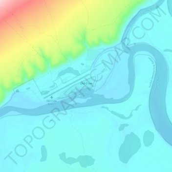
Name: Old Crow topographic map, elevation, terrain.

Location: Old Crow, Yukon, Unorganized, Yukon, Y0B 1N0, Canada (67.54890 -139.88240 67.59162 -139.76568)

Average elevation: 270 m

Minimum elevation: 237 m

Maximum elevation: 427 m

Yukon trails, hiking, mountain biking, running and outdoor activities

Gear up for your next adventure:

💧Hydration Pack - Hands-free hydration system for long hikes
🧰Multitool Knife - Compact and versatile tool for outdoor use
🔪Outdoor Multitool - Versatile tool for repairs and food prep in the wild
💡LED Camping Lantern - Illuminate your campsite with long-lasting lanterns
🧦Merino Wool Socks - Moisture-wicking comfort for long-distance hiking

As an Amazon Associate, this site earns from qualifying purchases at no extra cost to you.