Geolocate

Westminster topographic map

Click on the map to display elevation.

About this map

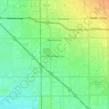
Name: Westminster topographic map, elevation, terrain.

Location: Westminster, Orange County, CAL Fire Southern Region, California, United States (33.71990 -118.04332 33.77410 -117.94462)

Average elevation: 14 m

Minimum elevation: 1 m

Maximum elevation: 33 m

Other topographic maps

Click on a map to view its topography, its elevation and its terrain.

Orange

United States > California > Orange County > Orange

Average elevation: 117 m

Hewes Park

United States > California > Orange County > Orange

Average elevation: 83 m

Gear up for your next adventure:

🧰Multitool Knife - Compact and versatile tool for outdoor use
👟Leg Gaiters - Keep debris, mud, and snow out of your boots
🔦LED Flashlight - Powerful and long-lasting flashlight for camping and emergencies
🧳Compression Sacks - Maximize space in your backpack by shrinking gear
🦶Hiking Shoe Insoles - Added support for high arches and long days on feet

As an Amazon Associate, this site earns from qualifying purchases at no extra cost to you.