Geolocate

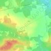
New Perth topographic map

Click on the map to display elevation.

About this map

Name: New Perth topographic map, elevation, terrain.

Location: New Perth, Town of Three Rivers, Kings County, Prince Edward Island, Canada (46.18576 -62.74887 46.23687 -62.65691)

Average elevation: 48 m

Minimum elevation: 6 m

Maximum elevation: 78 m

Kings County trails, hiking, mountain biking, running and outdoor activities

Other topographic maps

Click on a map to view its topography, its elevation and its terrain.
Dundee

Canada > Prince Edward Island > Kings County

Average elevation: 24 m

Gear up for your next adventure:

🧥Fleece Jacket - Warm and lightweight jacket for layering
💧Hydration Pack - Hands-free hydration system for long hikes
🧭GPS Outdoor Watch - Smart watch for navigation and fitness tracking in nature
⛺Bushcraft Tarp - Versatile emergency shelter or gear protection
🔭Outdoor Binoculars - Lightweight binoculars for birdwatching and hiking

As an Amazon Associate, this site earns from qualifying purchases at no extra cost to you.