
Make a donation
Gear up for your next adventure:
As an Amazon Associate, this site earns from qualifying purchases at no extra cost to you.
Worsley topographic map
Click on the map to display elevation.
Make a donation
Gear up for your next adventure:
As an Amazon Associate, this site earns from qualifying purchases at no extra cost to you.
Worsley
Worsley is a hamlet in northern Alberta, Canada within Clear Hills County. It is located in the Peace Country, at the northern end of Highway 726, approximately 18 km (11 mi) north of Highway 64, 59 km (37 mi) northwest of Hines Creek and 50 km (31 mi) east of the British Columbia border. It lies at an elevation of 650 m (2,130 ft) amidst prairie farmland and ranchland.
Make a donation
Gear up for your next adventure:
As an Amazon Associate, this site earns from qualifying purchases at no extra cost to you.
About this map
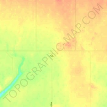
Name: Worsley topographic map, elevation, terrain.
Location: Worsley, Clear Hills County, Alberta, Canada (56.48768 -119.15315 56.52768 -119.11315)
Average elevation: 646 m
Minimum elevation: 617 m
Maximum elevation: 660 m
Clear Hills County trails, hiking, mountain biking, running and outdoor activities
Make a donation
Gear up for your next adventure:
As an Amazon Associate, this site earns from qualifying purchases at no extra cost to you.