Geolocate

Little Bromley topographic map

Click on the map to display elevation.

About this map

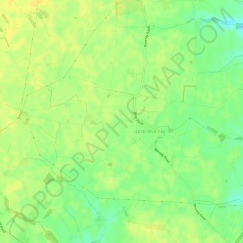
Name: Little Bromley topographic map, elevation, terrain.

Location: Little Bromley, Tendring, Essex, England, United Kingdom (51.89786 1.01730 51.93416 1.07247)

Average elevation: 32 m

Minimum elevation: 19 m

Maximum elevation: 40 m

Gear up for your next adventure:

🦶Anti-Blister Balm - Prevents friction and hotspots during long ascents
🧊Portable Cooler - Keep food and drinks cold during outdoor adventures
Tent Footprint - Protect tent floor and increase durability
🎒Hiking Daypack - Lightweight and durable backpacks for day trips and excursions
🌡️Emergency Mylar Blankets - Compact thermal protection for unexpected nights outdoors

As an Amazon Associate, this site earns from qualifying purchases at no extra cost to you.