Geolocate

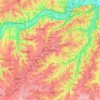
Nemaha County topographic map

Click on the map to display elevation.

About this map

Name: Nemaha County topographic map, elevation, terrain.

Location: Nemaha County, Kansas, United States (39.56595 -96.23957 40.00094 -95.78809)

Average elevation: 382 m

Minimum elevation: 311 m

Maximum elevation: 438 m

Other topographic maps

Click on a map to view its topography, its elevation and its terrain.
Cottonwood

United States > Kansas > Jefferson County

Average elevation: 294 m

Dalbey

United States > Kansas > Atchison County

Average elevation: 258 m

Harding Dam

United States > Kansas > Johnson County > De Soto

Average elevation: 252 m

Gear up for your next adventure:

🗺️Topographic Maps - Detailed maps to explore trails, mountains, and wilderness areas
🛌Down Sleeping Bag - Superior warmth-to-weight ratio for cold nights
🥾Trail Hiking Socks - Comfortable socks to prevent blisters and fatigue
💡Compact LED Flashlight - Powerful and portable flashlight for outdoor use
🧭GPS Tracker - Track your location in remote areas safely

As an Amazon Associate, this site earns from qualifying purchases at no extra cost to you.