Geolocate

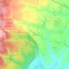
Cave topographic map

Click on the map to display elevation.

About this map

Name: Cave topographic map, elevation, terrain.

Location: Cave, Roma Capitale, Lazio, Italy (41.78768 12.90429 41.83762 12.96409)

Average elevation: 388 m

Minimum elevation: 239 m

Maximum elevation: 874 m

Other topographic maps

Click on a map to view its topography, its elevation and its terrain.
La Colonella

Italy > Lazio > Roma Capitale > Artena

Average elevation: 362 m

Gear up for your next adventure:

🎒Hiking Daypack - Lightweight and durable backpacks for day trips and excursions
🥾Waterproof Hiking Boots - Essential footwear for rugged terrain and wet Canadian trails
💡LED Headlamp - Hands-free illumination for night hiking and camping
👟Trail Running Shoes - Agile footwear for fast-paced topographic exploration
🥾Trekking Boots - Durable boots for long-distance trekking

As an Amazon Associate, this site earns from qualifying purchases at no extra cost to you.