
Sandhult topographic map
Click on the map to display elevation.
About this map
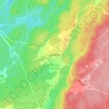
Name: Sandhult topographic map, elevation, terrain.
Location: Sandhult, Borås kommun, Västra Götaland County, 504 78, Sweden (57.74956 12.80094 57.78956 12.84094)
Average elevation: 237 m
Minimum elevation: 180 m
Maximum elevation: 299 m
Other topographic maps
Click on a map to view its topography, its elevation and its terrain.