Geolocate

Bodony topographic map

Click on the map to display elevation.

About this map

Name: Bodony topographic map, elevation, terrain.

Location: Bodony, Pétervásárai járás, Heves, North Hungary, Great Plain and North, 3243, Hungary (47.92546 19.93272 47.97471 20.06552)

Average elevation: 278 m

Minimum elevation: 181 m

Maximum elevation: 669 m

Other topographic maps

Click on a map to view its topography, its elevation and its terrain.
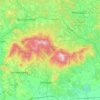
Mátra

Hungary > Great Plain and North > Heves

Average elevation: 285 m

Gear up for your next adventure:

🧊Portable Cooler - Keep food and drinks cold during outdoor adventures
🥾Mountain Trail Shoes - High-traction shoes for mountain trails
🥾Approach Shoes - Shoes designed for climbing approaches and rugged trails
🧴Sunscreen SPF - Broad-spectrum sunscreen for outdoor activities
🥘Camping Cookware Set - Compact nesting pots and pans for trail cooking

As an Amazon Associate, this site earns from qualifying purchases at no extra cost to you.