Geolocate

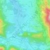
Rottach-Egern topographic map

Click on the map to display elevation.

About this map
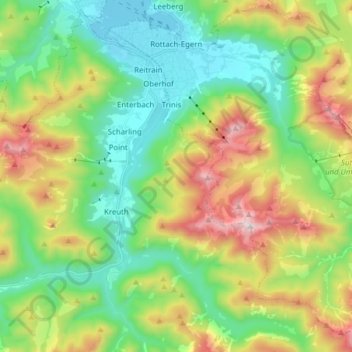
Name: Rottach-Egern topographic map, elevation, terrain.

Location: Rottach-Egern, Landkreis Miesbach, Bavaria, 83700, Germany (47.60086 11.73881 47.70233 11.89433)

Average elevation: 1,086 m

Minimum elevation: 724 m

Maximum elevation: 1,796 m

Other topographic maps

Click on a map to view its topography, its elevation and its terrain.
Gotzing

Germany > Bavaria > Landkreis Miesbach > Weyarn

Average elevation: 695 m

Sandbichl

Germany > Bavaria > Landkreis Miesbach > Marbach

Average elevation: 832 m

Buch

Germany > Bavaria > Landkreis Miesbach > Bad Wiessee

Average elevation: 904 m

Kalten

Germany > Bavaria > Landkreis Miesbach > Niklasreuth

Average elevation: 682 m

Floiger

Germany > Bavaria > Landkreis Miesbach > Miesbach

Average elevation: 769 m

Gear up for your next adventure:

🚑Survival Whistle - Signal for help across long distances in mountains
🧭GPS Handheld Device - Reliable GPS navigation for outdoor adventures
🛶Waterproof Dry Bags - Keep electronics and clothes dry during river crossings
🔥Camping Stove - Portable stoves to cook outdoors with ease
🛌Insulated Sleeping Pad - Critical thermal barrier between you and the cold ground

As an Amazon Associate, this site earns from qualifying purchases at no extra cost to you.